Biebrzański Park Narodowy - w trosce o bagna
Links
Access facilitation
Zmień język
Navigation:
- Environment
- Geology
Contents
Geology
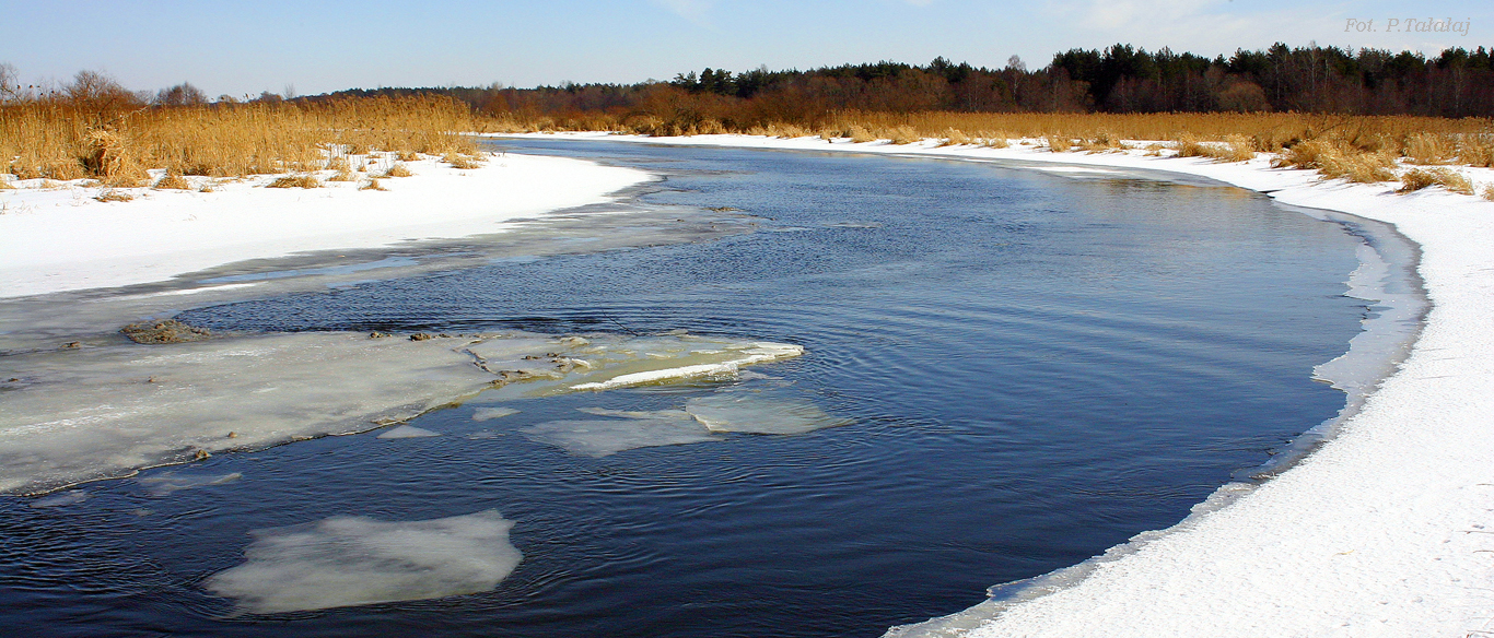
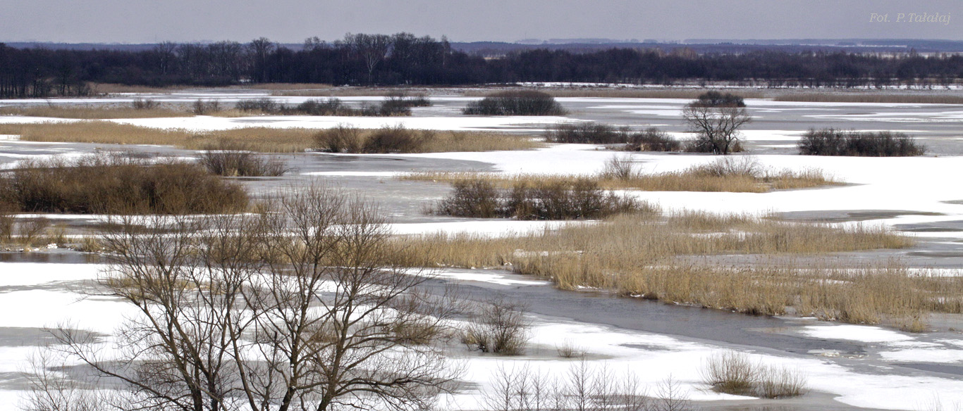
The Biebrza National Park covers a large part of the Biebrza valley, a huge depression more than 100 km long. The valley was formed during the central Polish and Baltic glaciations 10.000 - 30.000 years ago. Since that time, a peat layer has developed and in places is up to 10 m thick. This peatland complex covers about 90 000 ha and is the largest and the least disturbed of its kind in Central Europe. The Biebrza valley is surrounded from the east, south and west by morainic plateaux formed during the penultimate (Central Polish) glaciation. In the north, a morainic plateau, formed during the last (i.e. Baltic) glaciation borders the valley. At the Augustów outwash plain, the valley lies adjacent to a zone of deep kettles and lakes. The valley is naturally divided into three basins: the northern or upper basin (east of Sztabin), the middle basin (between Sztabin and Osowiec) and the southern or lower basin (between Osowiec and the Biebrza mouth).
The Upper Biebrza Basin is 40-km long and 1.5- 3.0 km wide. The peat deposit is 3 to 6 m thick and is partly underlain by calcareous gyttia. Characteristic features of the relief of the Upper Biebrza Basin are the moraine outcrops. The middle basin is a somewhat rectangular shape 40 km long and 20 km wide. It is a vast complex of peatlands (45,000 ha) with peat up to 3 m deep.Sands underlie the peat deposit with gravel series at the bottom of the northern part and silts and clays in the southern part. Extensive sandy tracts in many places transformed by eolic process to dunes and partly submerged by peat distinguish the middle basin. The Augustowski, Woznawiejski, Rudzki canals and several smaller canals (constructed in the first half of the 19th century) have changed hydrological regimes of this part of the valley, leading to a permanent drop in the water table and drainage of the peatlands. The Lower Basin is 30-km long and 12-15 km wide. The peat deposit is more than 2 m thick and is underlain by thick sandy-gravel beds, locally covered by loam and silt deposits. Small dunes forming islands several metres high are submerged in the peat of the surrounding flat flood plain. Numerous oxbows are situated in a 1-2 km wide muddy zone along the river.
News:
Banners on the right side
Contact data
Osowiec-Twierdza 8,
19-110 Goniądz
phone: +48 857380620,
857383000 ext. 233
fax: +48 857383021
e-mail:
sekretariat@biebrza.org.pl
Mapa
MapaIntranet
Footnote
CC 3.0: The Biebrza National Park
Consents settings, Project and Execution: extranet.pl
I am going up