Biebrzański Park Narodowy - w trosce o bagna
Links
Access facilitation
Zmień język
Navigation:
- Tourism
- Kayaking trails
Contents
Please note that the English version of the Biebrza National Park’s website is currently under construction. We do our best, but some information may be not updated yet.
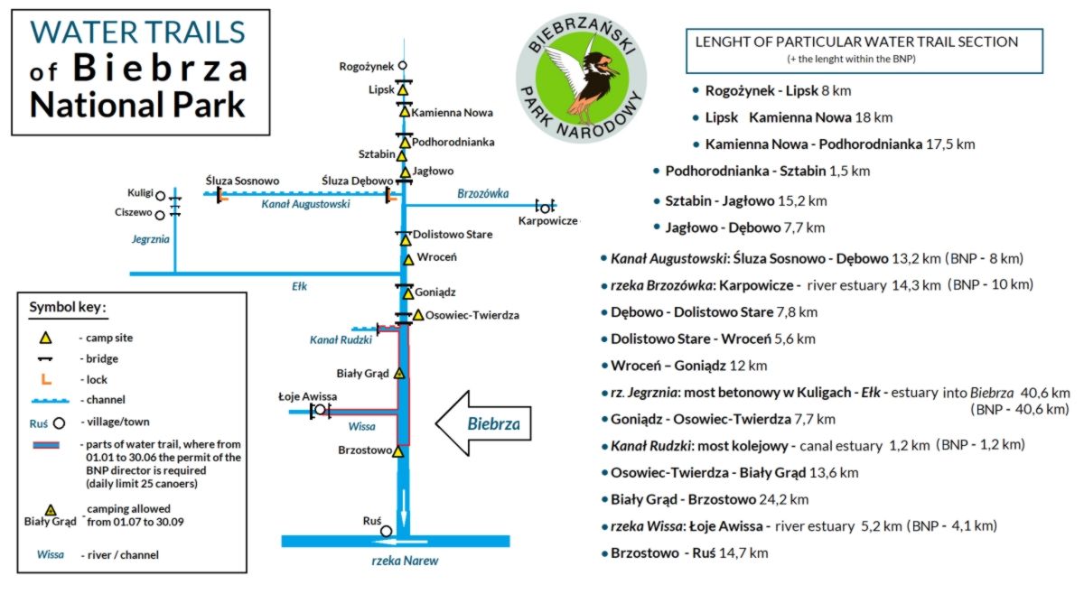
Water trails of the Biebrza National Park
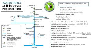 Map of the water trails in Biebrza National Park
Kayak/boat rental places in the Biebrza Valley: https://www.biebrza.org.pl/410,wypozyczalnie-sprzetu
Kayaking trails
Equipment
When visiting water trails of Biebrza National Park it is wise to take potable water containers. You may not get food supplies at every campsite . You may also need insect repellents and mosquito nets. Besides, standard kayaking equipment is recommended.
On Jegrznia river trails there could be blockages causing serious difficulties.
There is a one-off limit of 25 persons in a group. Standard tourist traffic rules are in use: Rules of visiting and access to tourist facilities of BNP. Water trail entrance cards can be obtained here:
translated by Joanna Chmielewska; 2014
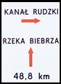
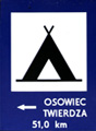
On our water trails you will see following signs:
 proper kayaking direction
 river tributary and distance to the trail end
 distance to campsite


 attraction of environmental value
 campsite and distance to the trail end
 village/town name and distance to the trail end

Kayaking permit
You should obtain kayaking permit from 1 January to 30 June each year, on following distances:
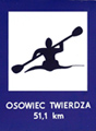
- Osowiec - Brzostowo. This part - 38 km – should be passed in 1 day, no possibility of overnight stay on "Biały Grąd" campsite.
- Rudzki Channel - from railway bridge to Biebrza river
- On Wissa river, from Łoje-Awissa village to Biebrza river
Daily limit for above distances is 25 visitors.
In order to obtain the permit call Biebrza National Park Accessibility Team +48 85 738 30 35 e-mail: it@biebrza.org.pl and order the reservation confirmation, noting: precise date of passage (1 DAY !!!), number of visitors, number of kayaks, name and address of the kayaking organiser, phone number.
You can receive the permit exclusively in Biebrza National Park Headquarters, in person only.
Note that you should have entrance cards for water trails with your kayaking permits.
translated by Joanna Chmielewska; 2014
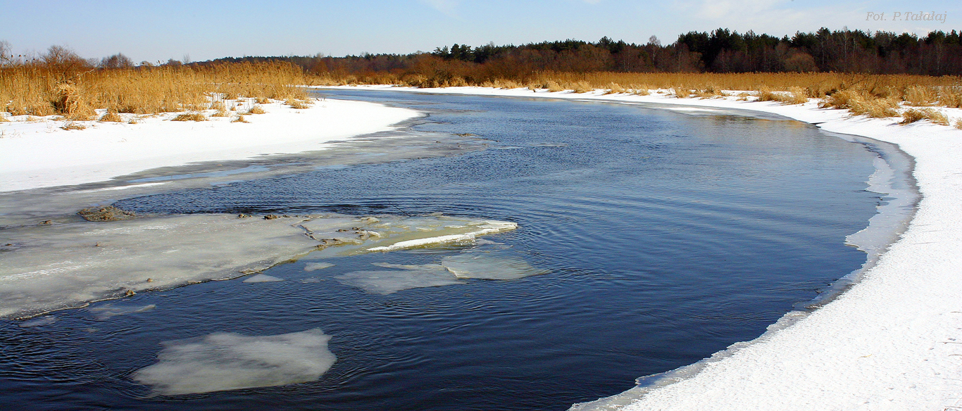
The Biebrza River water trail
The Biebrza River - 145,7 km; easy trail
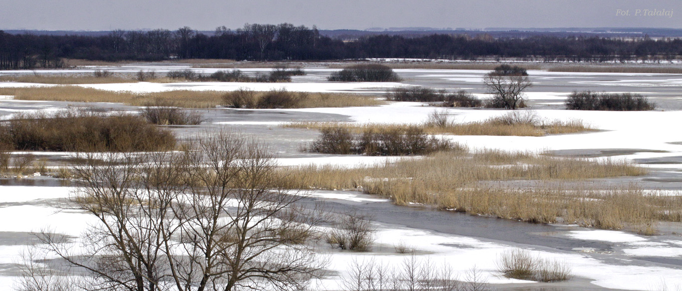
The only disadvantages could be dense vegetation in the river bed in the second part of summer (mainly at the north part of the park) and ... mosquitos! Rivers banks are very often inaccessible from kayak. The open landscape, strong river meanders, old river beds and vast flooding during a spring as well as variety of birds species are the main atractions, which easily recompense possible problems. Campsites along the river have different standard: with showers and toilets in Osowiec-Twierdza and Goniądz, but without any infrastructure in Kamienna Nowa.
For kayaking/canoeing on the distance between Osowiec and Biały Grąd from 1st January till 30 of June, please obtain a permit from the Park Manager and valid admission tickets. This restriction is made due to the birds' nesting season.
The Jegrznia River trail, from Rajgrod to Osowiec-Twierdza
Jegrznia and Ełk River It is typical lowland kaykaing trail with very slow current, partly covered with dense vegetation in the river bed. Trail starts at the Rajgrodzkie Lake, goes through the Jegrznia River, the Drenstwo Lake and reach Woznawies village. It enters into BNP on 21,5 km distance and goes along the edge of “Czerwone Bagno” protected zone among wet meadows and the Ełk River. The only place to camp on the way to the Biebrza River is at the Elk old river bad at spot called Debiec (to get there it is necessary enter 2 km into the Elk old river bad). The confluence of the Biebrza and the Elk River is below Wrocen village. Further continue the trip with the Biebrza River.
The Augustowski Canal water trail, from Augustow to the Biebrza River
The Augustowski Canal Augustów - Białobrzegi lock – Borki lock – Sosnowo lock - Dębowo lock - the Biebrza river trail description
Kumiałka and Brzozówka river water trail
Kumiałka – Brzozówka trail is 44,6 km long.
The first part of the trail (about 13 km) is along Kumiałka river. In Zabrodzie and Szumowo village area the river flows through a narrow forested valley, which may be difficult to pass due to fallen trees and branches intruding into the river channel. There are two bay areas: near Mielewszczyzna village and in Korycin with a campsite and bathing area.
There is a need to carry the equipment on weirs in Korycin (8,8 km of the trail) and Mielniki village (11,2 km of the trail). We then enter Brzozówka river (31,7 km). There can be lots of water plants in lower part of the river that may form obstacles. However, natural miracles of meandering river with abundant flora and fauna are definitely worth seeing. In the second part of the year going through this trail can be comparable to exploring the Amazon.
When the water is high there may be problem with lower footpaths in Brzozowa village area (Syberia). On the 30 km of the trail, near Karpowicze village, there is a bay with bathing area and a campsite. You can buy food supplies in a local shop.
Sidra Water Trail
Sidra River, left bank tributary of Biebrza, 32,8 km length.
The trail leads through spectacular valley 1 to 2 km wide, partially swampy, largely meliorated, used as pasture and meadow. Trail length from Sidra village Biebrza river mouth is 20 km.
The best option is to start the trail at Water Sports Center (Ośrodek Sportów Wodnych) near the bay, where a campsite exists, or in Siderka village below the portage on 15,3 km of the trail. Sidra river can be a remarkable experience before slow Biebrza trail since visitors should be very cautious here due to lots of riffles. You also have to watch out for low footbridges, tree branches and encroached river bed. There will be portages which depend on water levels. When the level is low, 2 concrete steps are an obstacle – invisible when the levels are high – and concrete floodgates (usually open) with wooden poles behind it.
Rudzki Channel Water Trail
Rudzki Channel Water Trail: Modzelówka – Biebrza – 16,7 km
Modzelówka – Sojczyn Grądowy – Przechody – Białogrądy – Osowiec – Biebrza
Rudzki Channel was built in XIX century. There is a river weir in Modzelówka village directing water of Ełk river into a man-made bed. Below the weir Ełk is generally impossible to pass due to inactive river channel, which needs time to be filled with water from bogs.
News:
Banners on the right side
Contact data
Osowiec-Twierdza 8,
19-110 Goniądz
phone: +48 857380620,
857383000 ext. 233
fax: +48 857383021
e-mail:
sekretariat@biebrza.org.pl
Mapa
MapaIntranet
Footnote
CC 3.0: The Biebrza National Park
Consents settings, Project and Execution: extranet.pl
I am going up